
PowerPoint Maps of EMEA – PowerPoint PPT Template
PowerPoint (PPT) 49 Slides
POWERPOINT MAP DIAGRAMS PPT TEMPLATE DESCRIPTION
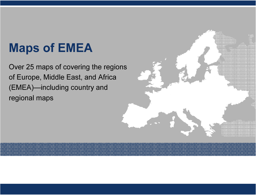
A collection of over 25 PowerPoint maps of covering the regions of Europe, Middle East, and Africa (EMEA)—including country and regional maps. Maps are editable. Individual countries can be selected and colored.
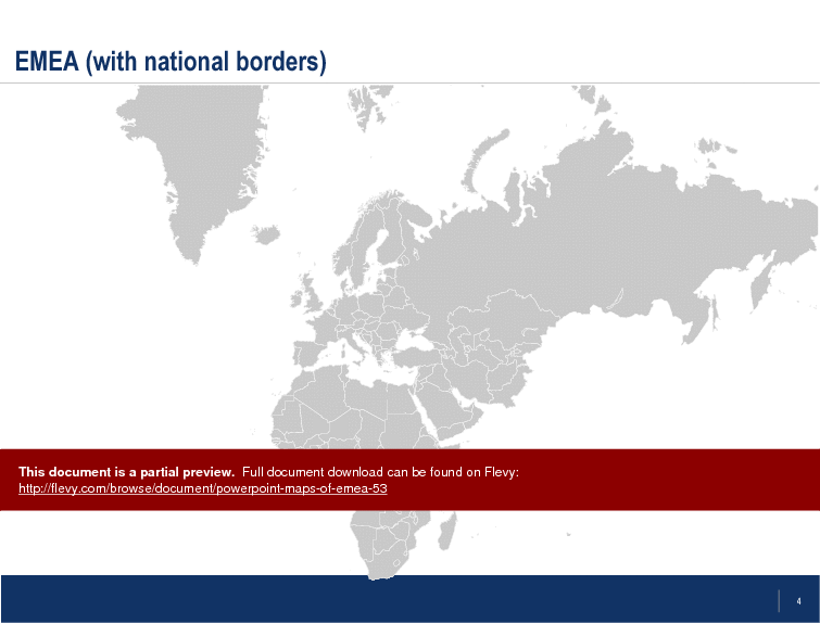
This PowerPoint deck offers a comprehensive suite of maps for the EMEA region, meticulously detailed to support your strategic presentations. Each map is fully editable, allowing you to customize colors and highlight specific countries or regions. Whether you need to focus on Europe, the Middle East, or Africa, these maps provide a clear and professional visual aid.
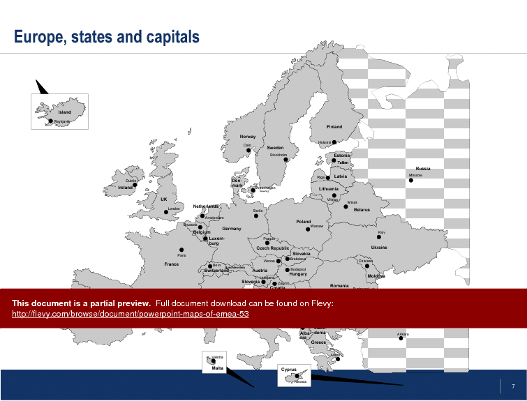
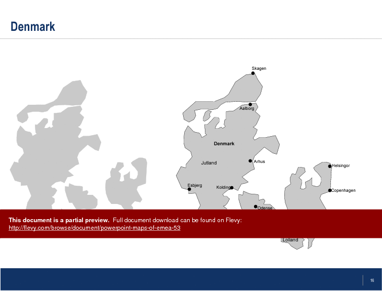
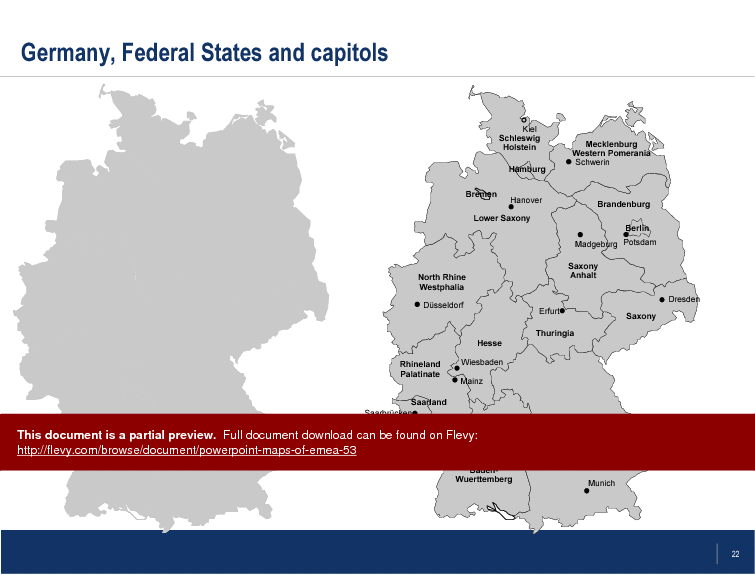
The maps include detailed views of individual countries, complete with major cities and capitals. This level of detail is crucial for market analysis, regional planning, and strategic decision-making. The ability to isolate and modify specific areas ensures that your presentations are both precise and impactful.
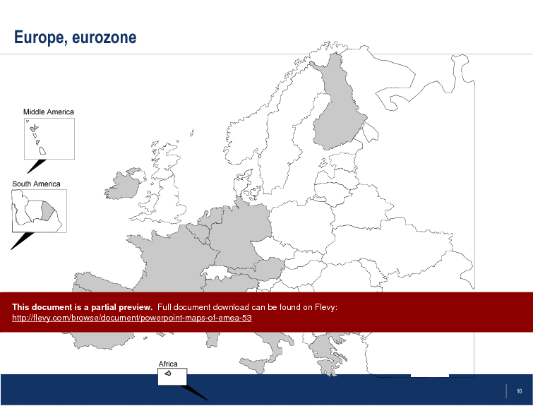
The document also features specialized maps such as the Eurozone and various regional subdivisions. These are particularly useful for financial presentations, economic reports, and policy discussions. The clarity and accuracy of these maps will enhance your ability to communicate complex information effectively.
For executives and business leaders, these maps are indispensable tools for visualizing data and trends across the EMEA region. The ease of customization means you can tailor each map to fit your specific needs, making your presentations more engaging and informative.
Got a question about the product? Email us at support@flevy.com or ask the author directly by using the "Ask the Author a Question" form. If you cannot view the preview above this document description, go here to view the large preview instead.
Source: Best Practices in PowerPoint Map Diagrams PowerPoint Slides: PowerPoint Maps of EMEA PowerPoint (PPT) Presentation Slide Deck, LearnPPT Consulting
ABOUT THE AUTHOR
We are a team of management consultants trained by top tier global consulting firms (including McKinsey, BCG, Deloitte, EY, Capgemini) with a collective experience of several decades. We specialize in business frameworks based on real-life consulting engagements.
We have served 100s of clients that range from Fortune 500 companies to tech startups to
... [read more]
Ask the Author a Question
You must be logged in to contact the author.
