

PowerPoint Maps of Countries & Regions – PowerPoint PPT Template
PowerPoint (PPT) 72 Slides
POWERPOINT MAP DIAGRAMS PPT TEMPLATE DESCRIPTION
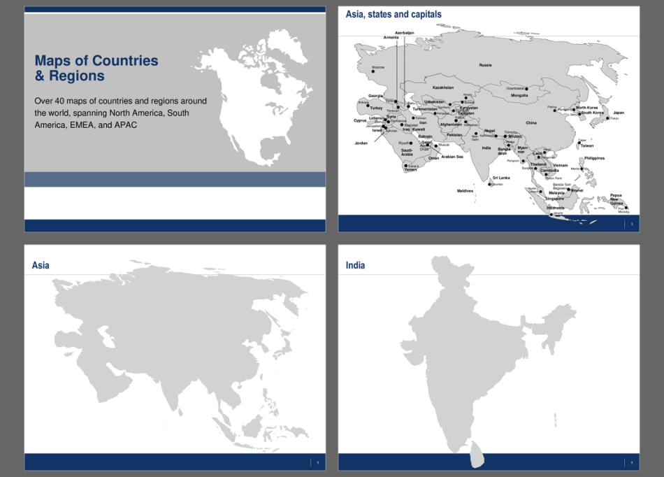
Over 40 maps of countries and regions around the world, spanning North America, South America, EMEA, and APAC, as PowerPoint templates. Maps are editable. Individual countries can be selected and colored.
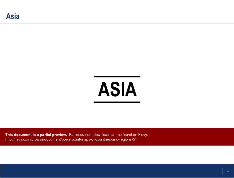
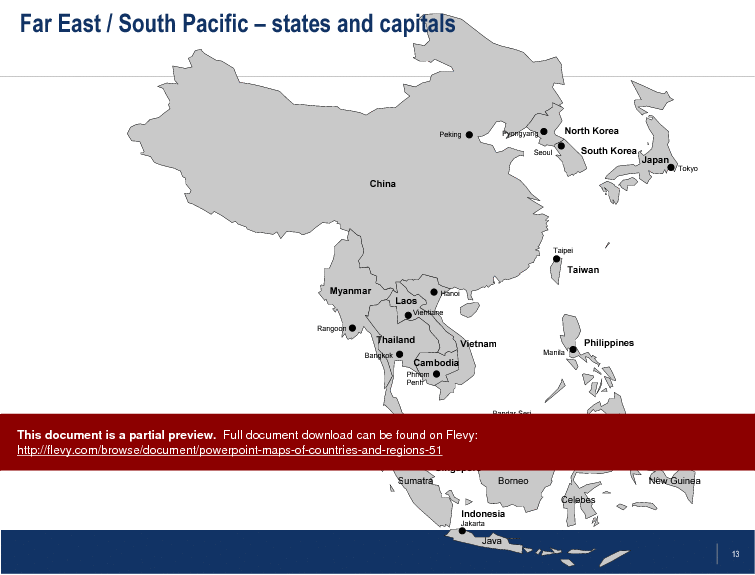
These PowerPoint maps offer a comprehensive visual tool for presenting geographic data with precision. The document includes detailed maps of regions like Asia, India, and the Middle East, allowing for granular analysis and presentation. Each map is meticulously designed to highlight states and capitals, ensuring that your audience can easily grasp the geographic context.
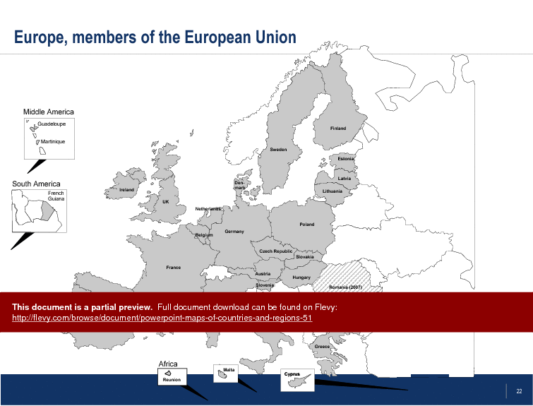
The maps of Europe, including detailed views of countries such as France, Germany, and the Czech Republic, provide a robust framework for any presentation. These maps are particularly useful for market analysis, regional strategy sessions, and demographic studies. The ability to customize colors and select individual countries enhances the flexibility of these templates.
For presentations focused on the Americas, the document includes maps of Central America, Canada, and the United States. The U.S. maps, with individually colored states, are ideal for illustrating regional trends, sales territories, or logistical planning. These maps are designed to be both informative and visually appealing, making them a valuable asset for any business presentation.
The inclusion of maps from diverse regions such as Australia and the Far East/South Pacific ensures that this document caters to a global audience. Whether you are presenting to stakeholders, conducting a regional analysis, or planning an expansion strategy, these editable PowerPoint maps provide the clarity and detail needed to convey your message effectively.
Got a question about the product? Email us at support@flevy.com or ask the author directly by using the "Ask the Author a Question" form. If you cannot view the preview above this document description, go here to view the large preview instead.
Source: Best Practices in PowerPoint Map Diagrams PowerPoint Slides: PowerPoint Maps of Countries & Regions PowerPoint (PPT) Presentation Slide Deck, LearnPPT Consulting
ABOUT THE AUTHOR
We are a team of management consultants trained by top tier global consulting firms (including McKinsey, BCG, Deloitte, EY, Capgemini) with a collective experience of several decades. We specialize in business frameworks based on real-life consulting engagements.
We have served 100s of clients that range from Fortune 500 companies to tech startups to
... [read more]
Ask the Author a Question
You must be logged in to contact the author.
